In synchronous, a coordinate system is a set of planes and axes used to assign coordinates to features, parts, and assemblies. You can also draw sketches on the principal planes associated with a coordinate system.
There are two types of coordinate systems:
Base coordinate system
User-defined coordinate systems
When constructing synchronous parts, you typically use the principal planes of the base coordinate system to draw 2D sketches in 3D space.
You can use a coordinate system to position a part in an assembly. You can measure distances relative to a coordinate system with the Measure Distance and Measure Minimum Distance commands. You can display and hide the base coordinate system. Coordinate systems are displayed in the Coordinate System collection in PathFinder.
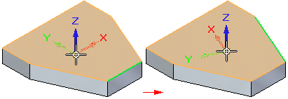
The Base coordinate system is displayed at the origin of a new part or assembly document. When constructing synchronous parts, you typically use one of the principal planes of the base coordinate system to draw a 2D sketch for the first feature of a new part. For example, you can draw the first sketch for a new part on the principal XY plane of the base coordinate system. You can also place dimensions and geometric relationships relative to the primary axes of the coordinate system.
When you create a user-defined coordinate system, you can position the coordinate system relative to model geometry, another coordinate system, or in empty space.
When placing a user-defined coordinate system, you can use the shortcut keys to control the orientation of the coordinate system. When placing a coordinate system on a model face, the coordinate system is positioned relative to linear edges on the face. For example, you can use the N key to choose another model edge to orient the coordinate system. The valid shortcut keys are displayed in PromptBar while you are placing the coordinate system.